Home › Grade 4 › social-studies
Reading U.S. Maps
Practice reading physical and political maps with 10 problems, an answer key, and a free printable PDF for Grade 4.
10 problems · Standards: D2.Geo.1.3-5, D2.Geo.2.3-5 · Difficulty: medium
✅ Answer key included · ✅ Free for home & classroom use
Highlights
- Grade
- Grade 4
- Subject
- social-studies
- Pages
- 3 · worksheet + answer key
- Answer key
- ✅ Included
- Class time
- about 15 min
What's inside
- 1. A compass rose shows four main directions. Which direction is opposite of south?
- 2. On a map legend, a star symbol inside a circle represents a state capital. What does a plain dot usually represent?
- 3. A map shows that River Valley is located at the point where two blue lines meet. What geographic feature do blue lines usually show on a map?
- 4. The legend shows that dark green areas have elevations above 5,000 feet, and light green areas have elevations below 1,000 feet. Which color shows higher land?
- 5. A political map shows that Pine City is 2 inches from Ocean Town. The map scale says 1 inch equals 50 miles. How many miles apart are the two cities?
- 6. A map legend shows that a thick black line means a state boundary and a dotted line means a county boundary. State A and State B are separated by a thick black line. State A and State C are separated by a dotted line. What kind of boundary is between State A and State C?
Showing 6 of 10 problems. The free PDF includes every problem plus the full answer key.
Preview
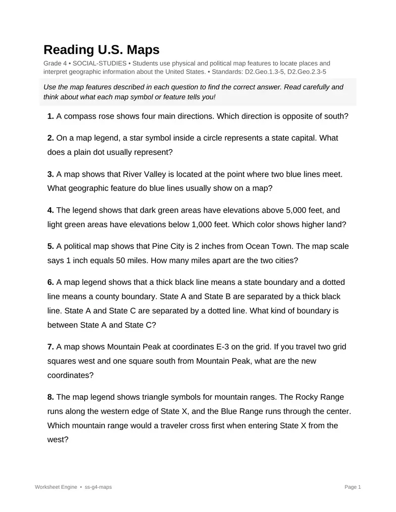
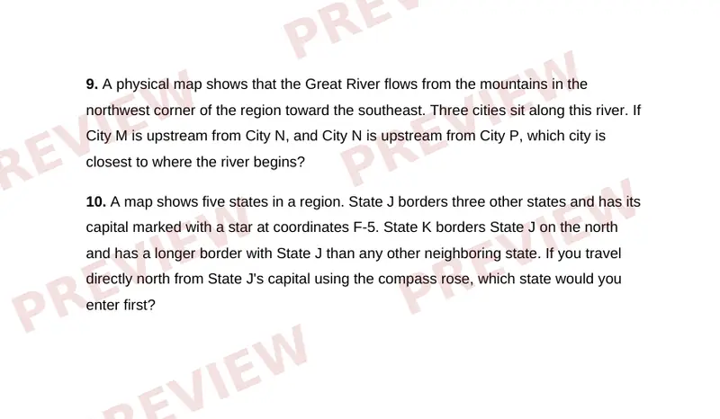
The free PDF includes all 3 pages — every problem plus the full answer key.
What’s included
- 10 problems across 3 pages (worksheet + answer key)
- Answer key included — every answer, ready to check
- Standards: D2.Geo.1.3-5, D2.Geo.2.3-5
- Skill: Students use physical and political map features to locate places and interpret geographic information about the United States.
- Suggested use: classwork, homework, or sub plans
Reviews
Loading reviews…
More grade 4 social-studies worksheets
The Three Branches of Government
Practice the three branches of government with 10 problems, an answer key, and a free printable PDF for Grade 4.
Understanding the Bill of Rights
Practice the Bill of Rights with 10 problems, an answer key, and a free printable PDF for Grade 4.
Life in the Thirteen Colonies
Practice the thirteen colonies with 10 problems, an answer key, and a free printable PDF for Grade 4.
Explorers and Their Routes
Practice European explorers and their routes with 10 problems, an answer key, and a free printable PDF for Grade 4.